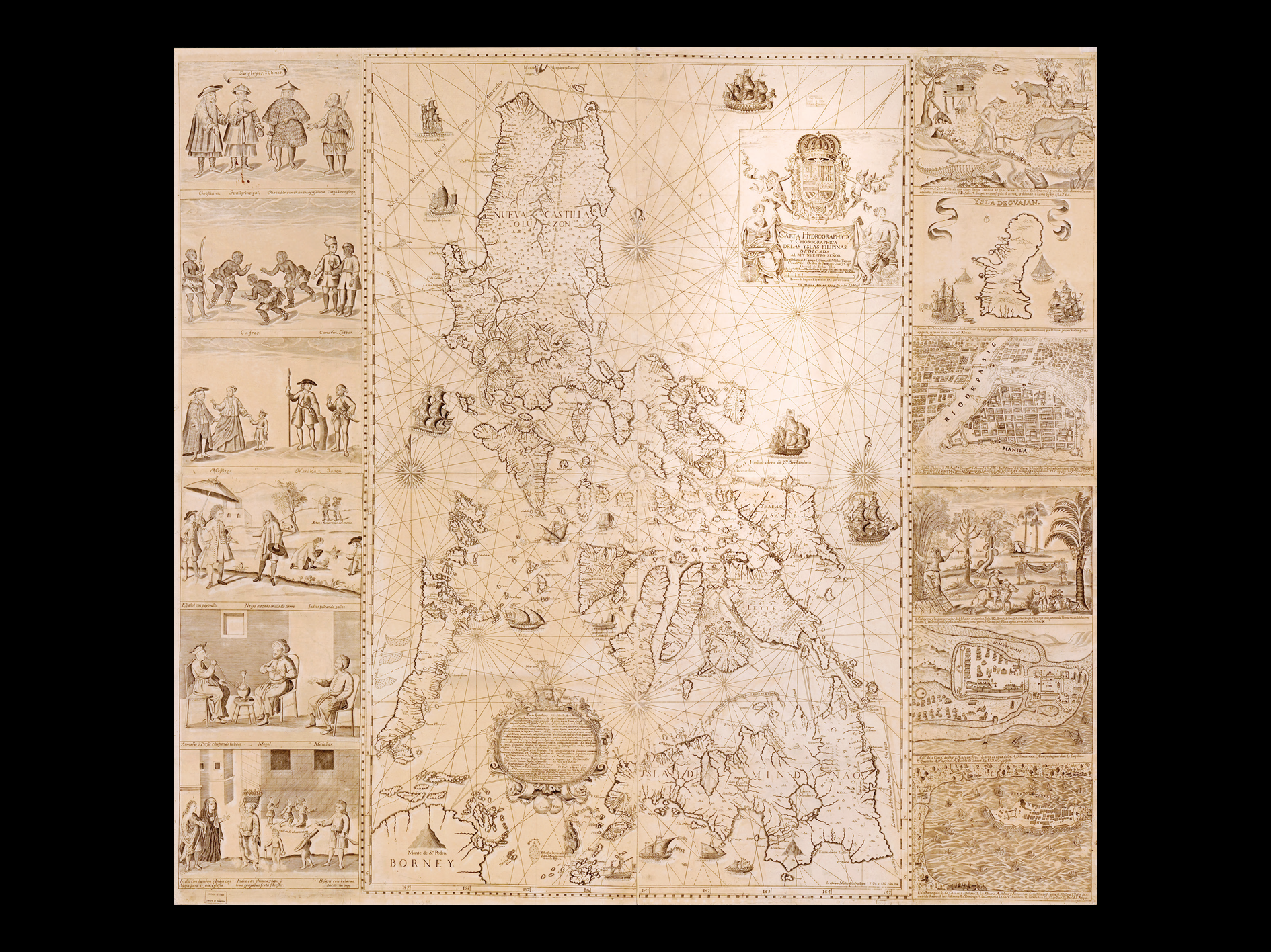
Nicolas de la Cruz Bagay, Francisco Suarez, and Pedro Murillo Velarde
Carta Hydrographica y Chorographica de las Yslas Filipinas (Hydrographical and Chorographical Chart of the Philippine Islands)
1734
Print
68.58 x 106.68 cm
Private collection of Fernando M. Zobel de Ayala
on long-term loan to Ayala Corporation
The Jesuit cartographer Pedro Murillo Velarde was tasked by then Governor General Fernando Valdes Tamon to chart an accurate map of the Philippine Islands. Velarde sought the help of two highly skilled Tagalog artists, Nicolas de la Cruz Bagay and Francisco Suarez, to render the map, with the two artists adding panels on each side depicting various scenes of life in Manila. The map is hailed by the World Digital Library to be the “first and most important scientific map of the Philippines.” The map has been widely reproduced in different variations, with some reducing the map or excluding the panels on the sides.